Thermal Drone Surveys For Bats
Thermal drone bat surveys use drone-mounted thermal imaging cameras to support the assessment of bat emergence and activity by providing an additional aerial perspective. Advances in thermal imaging, combined with automated analysis and rigorous human-in-the-loop interpretation, support robust and transparent assessment of bat emergence behaviour.
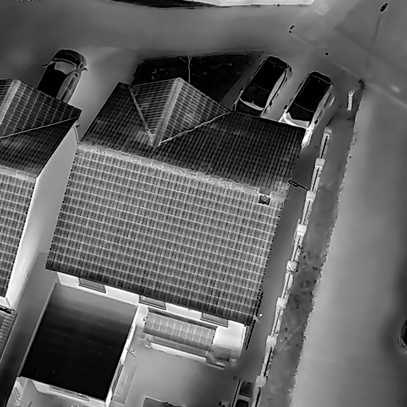
The approach is particularly suited to complex sites where roof structures, roof valleys, high elevations or recessed features are not readily visible from the ground. It can also be applied to smaller structures and trees, improving coverage of features, elevations and surrounding habitats where access or lines of sight are constrained.
Surveys may be undertaken alongside conventional emergence survey methods or, where justified by site context and survey objectives, as a standalone approach.
All surveys are designed, supervised and interpreted by a bat-licensed ecologist, with careful consideration of disturbance, safety and relevant ecological and aviation requirements, in line with up-to-date best practice guidance for bat surveys.
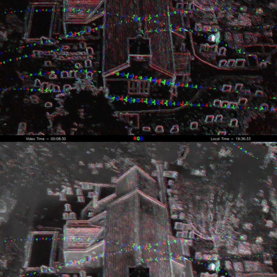
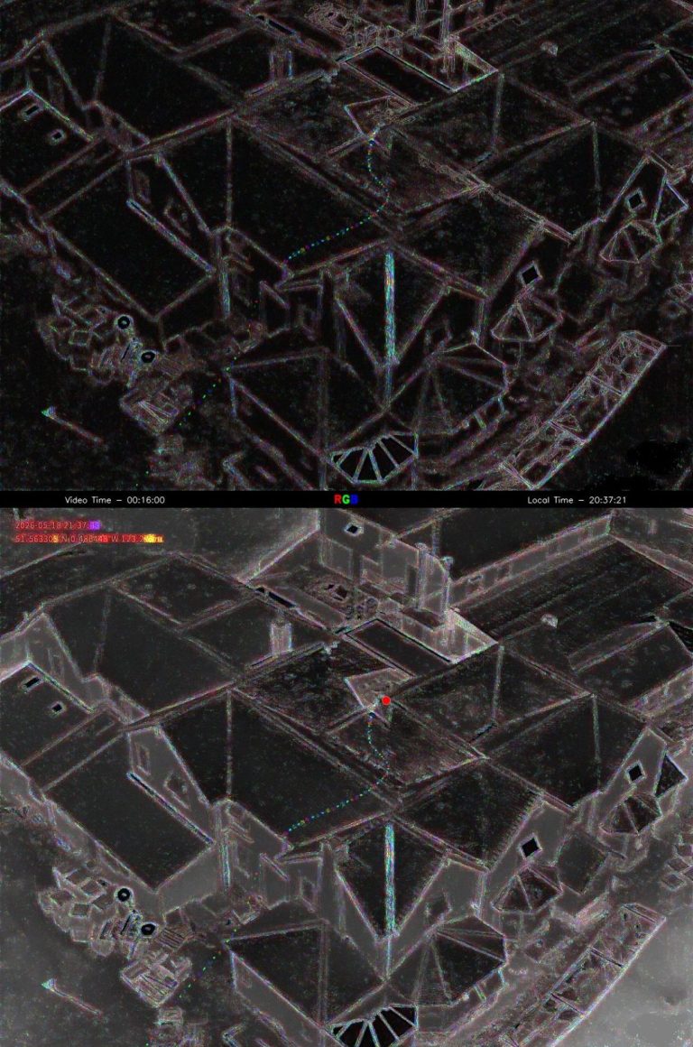
Thermal imagery is processed using Wildlife Imaging Systems movement-tracking software, followed by structured manual review to verify detections and interpret behaviour.
Outputs are provided as clear, quality-assured technical evidence to support ecological impact assessment, mitigation design and, where appropriate, bat mitigation licence applications. Technology is used to enhance survey coverage and confidence in interpretation, not to replace professional ecological judgement.
Surveyor Experience & Accreditation
Led by a fully insured, bat-licensed ecologist with over 20 years’ professional experience in ecological survey, assessment and interpretation.
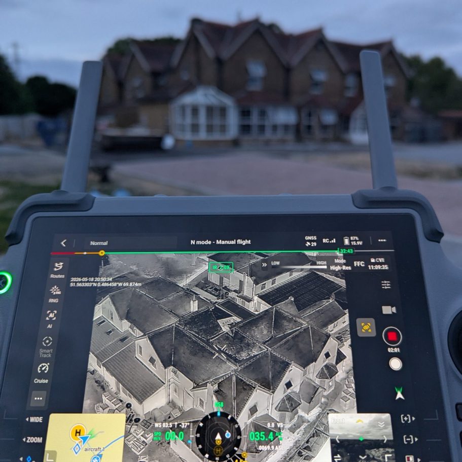
Qualified drone pilot with over 100 hours of operational flight experience, operating under CAA Operational Authorisation (PDRA01).
General Visual Line of Sight Certificate (GVC) and A2 Certificate of Competency (A2 CofC) held.
Surveys designed, flown and interpreted in line with current bat survey best practice and aviation guidance.
Public liability and professional indemnity insurance maintained for all survey activities.
Site-specific RAMS, airspace checks and pre-survey liaison undertaken for each site.
Drone used for thermal work is a DJI Matrice 4T.
Survey Protocols
Key protocol elements include:
Daytime site visit to inform survey design, identify constraints, confirm suitable take-off and landing locations, and plan safe flight paths.
Site-specific risk assessment (RAMS) and ecological survey design.
Airspace checks, with liaison and prior approvals obtained where required.
Controlled take-off and landing procedures, including suitable launch locations and exclusion zones.
Careful flight planning to minimise potential disturbance to bats and other wildlife.
Deployment of ground-based ultrasonic bat detectors, where appropriate, to support interpretation of bat activity.
Timed battery changes and flight durations, planned to maintain survey continuity during emergence periods.
Ongoing weather and conditions checks to ensure safe and appropriate survey delivery.
Ecological oversight by a bat-licensed ecologist throughout survey delivery.
Analysis and Interpretation
Use of Wildlife Imaging Systems automated movement tracking tools, supported by rigorous human-in-the-loop check.
Review and interpretation undertaken in line with Bat Conservation Trust (BCT) and CIEEM guidance.
Analysis and interpretation of ground-based ultrasonic detector data. Summerised and used to support image data.
Interpretation of other client supplied ground-based imagery (Thermal MP4 and Near-infrared) and acoustic data, where available.
Clear documentation of assumptions, limitations and survey context, in accordance with best practice guidance.
Outputs presented in a clear, proportionate format to support ecological assessment and decision-making.